


발리 랜드 조닝: 건축이 허용되는 위치
If you want to buy land in Bali, build a home, open a business, or invest in a rental project, you need to understand Bali land zoning first. This is one of the first things serious buyers check, and for good reason. A plot can look perfect in photos, sit next to beautiful villas, and still be the wrong zone for your plan.
In land zoning in Bali, many people focus only on price, view, or road access. That is a mistake. Before you fall in love with a plot for your dream villa, your commercial property, or your next property investment, you should check land zoning and confirm the land zoning status. This step can save you from expensive surprises.
This guide explains the six main land zones, how to read an official zoning map platform, how to think about zoning rules, and why zoning regulations are not the same as ownership rules. That last point matters a lot for foreign investors and other buyers who are comparing real estate investment options.
What does Bali land zoning mean
Bali’s land zoning is part of a broader planning system that governs how land can be used. These land zoning regulations help guide growth, protect important areas, and reduce conflicts between farming, housing, business, tourism, and environmental needs.
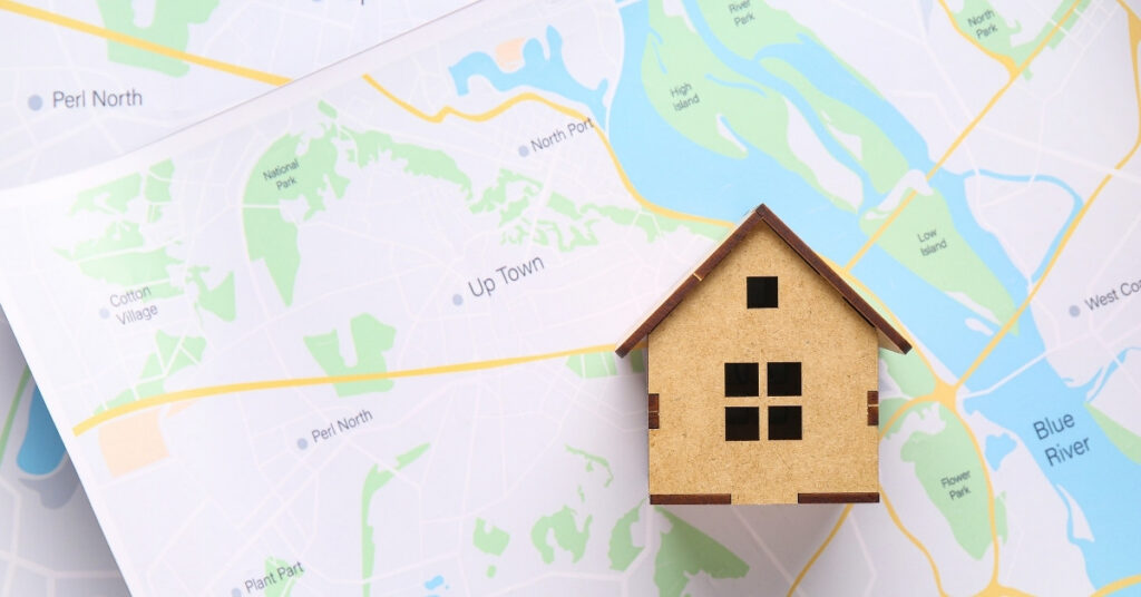
When you look at a zoning map, you are looking at a visual guide to the different land zones in a district or across the province. Each color represents a zoning classification, and that classification gives you an early idea of what a plot is generally meant for, along with its likely land use restrictions.
This matters because Bali has to balance a lot at once. The island needs space for the tourism industry, homes, roads, and jobs, but it also has to protect agricultural resources and maintain ecological balance. That is why good land zoning regulations are so important. They are designed to support sustainable development, cultural preservation, and the local economy all at the same time.
So before you plan residential development, commercial development, a villa rental business, or even a private home, start with one key question: what is this land zoned for? That answer should come before price, design ideas, or future profit projections.
The six main land zones in Bali
When people talk about the mainland zones, they usually mean six broad categories used in everyday property discussions: green zone, yellow zone, red zone, pink zone, orange zone, and protected or conservation areas.
| Zone | Main Use | 최상의 대상 | Main Risk |
| Green Zone | 농업 | Farming, open land | Usually not ideal for villas or business use |
| Yellow Zone | Residential | Private homes | Must still verify local rules |
| Pink Zone | Tourism | Hospitality, tourism land, private villas, rental villas | Not every tourism project is automatically allowed |
| Red Zone | Commercial | Shops, offices, business use | Extra commercial rules may apply |
| Orange Zone | Mixed use | Residential + business mix | Needs closer review of the intended use |
| Conservation Zones | Protection | Environmental and heritage protection | High restrictions on development |
Green zone
그리고 녹색 영역 is often the first zoning term you hear when people talk about land in Bali. In simple terms, it usually refers to agricultural land or land intended to remain open for farming, food production, or environmental use.
This zone helps control overbuilding. So when someone casually says a plot is “convertible,” do not take that at face value. What really matters is the official zoning status and the legal rules for that specific land. In many cases, construction or land alteration on green zone land is subject to strict limits.
Many buyers see rice fields, open views, and peaceful surroundings, and then picture a dream villa. But green zone land is usually the most restricted category for that kind of plan. It is often tied to agricultural activities, water systems, and other land uses that protect agricultural resources.
This matters for more than farming. Some green areas support Bali’s famous rice terraces and parts of its UNESCO cultural landscape. Protecting these fertile lands also helps preserve water systems, scenery, food security, and cultural preservation.
Yellow zone
그리고 yellow zone is usually the starting point for residential land. This is the zone many people think of when they want a home, a family compound, or other residential properties. In broad terms, yellow zone land is associated with residential zones, residential neighborhoods및 residential buildings.
If you want to build or buy a private home, this zone often makes more sense than green land. It is generally intended for housing and normal community growth. Still, you should not assume every yellow zone works the same way. Local details still matter, including building form, road access, setbacks, and other local regulations.
Red zone
그리고 red zone is usually associated with commercial land and more intensive business activity. This is the kind of area you look at when you want to open a business, shops, offices, warehouses, service businesses, or other commercial activities. In busier urban areas, a red zone may also be part of central business districts, main commercial corridors, or high-density business areas.
That said, you should not assume a red zone gives you unlimited freedom. Zoning rules, building codes, access requirements, parking standards, and local permit steps may still apply. The zone can point you in the right direction, but you still need to review whether your specific project actually fits.
Pink zone
그리고 pink zone is the category that many people connect with tourism land 또는 tourism zones. Since Bali has such a strong visitor market, this zone gets a lot of attention from brokers, developers, and 외국인 투자자.
If you are looking at a hotel site, hospitality project, or commercial villa concept tied to the tourism industry, a pink zone can be very important. It usually makes more sense for tourism use than standard residential land.
That said, you should not assume every pink plot is automatically ready for any tourism project. What it does mean is that the land-use direction is generally more aligned with tourism than with a purely residential area. So if you are thinking about rental villas, a resort-style project, or another visitor-focused business, the pink zone deserves a close look.
Still, do not confuse a beautiful area with legally suitable tourism land. A pretty view does not guarantee the right zoning. You always need to check the map.
Orange zone
그리고 orange zone usually refers to mixed use. That means residential and commercial uses can exist in the same general area, depending on the local plan and the type of activity. That is why orange zone land can appeal to you if you want a project that combines 주거용 그리고 commercial space.
For example, this kind of area may work for a building with a shop on the ground floor and housing above it, or for a business located near homes. It can be a practical option in growing towns, where residential and commercial activity often overlap.
Still, you should be careful. Mixed use does not mean you can do anything you want. It only means the planning rules may allow more than one type of use. You still need to check whether your exact activity is actually allowed and whether it fits the local framework.
Conservation zones
The last broad category covers protected land, often referred to as conservation zones. These are some of the most sensitive areas in Bali. They can include forest reserves, coastal buffers, water catchment areas, and other environmentally sensitive areas.
These zones exist to protect the land, not to support development. They may help preserve environmental safety, reduce natural risks, protect heritage value, and support conservation projects. They also play an important role in ecological balance. So if you are looking at land in this category, you need to treat it very carefully.
If a plot sits in or near conservation zones, you should be extra cautious. That matters even more when the land is close to water, steep slopes, protected habitats, or cultural sites. In many cases, this kind of location creates the biggest risk of a mismatch between the land and what you want to do with it.
How to check land zoning in Bali
If you want to check land zoning in Bali, you can do it through the official GISTARU Bali website. On the site, you’ll see the Sistem Informasi Tata Ruang map and the menu panel on the left. The zoning layer you need is under Rencana Pola Ruang.
Open the GISTARU Bali Website
If you want to check land zoning in Bali, start by opening the official GISTARU Bali website. Once the page loads, you’ll see the Sistem Informasi Tata Ruang map in the middle and a menu panel on the left side. The part you need for zoning is called Rencana Pola Ruang.
Find the Rencana Pola Ruang Section
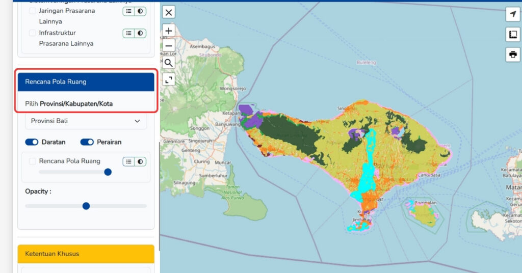
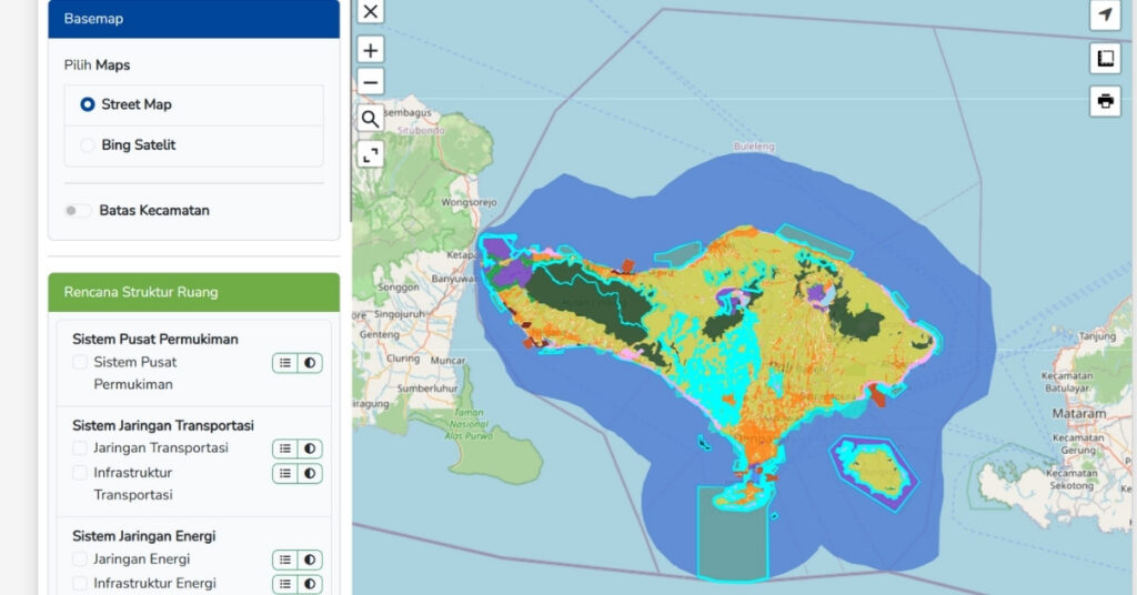
After the map opens, look at the menu on the left. You do not need to use sections like Basemap 또는 Rencana Struktur Ruang for this step. Just scroll down until you find Rencana Pola Ruang, because that is where the zoning layer is located.
Choose the Area You Want to Check
에서 Pilih Provinsi/Kabupaten/Kota dropdown, choose the area you want to review. If you want to see zoning across the whole island, leave it on Provinsi Bali. If you want to check a more specific area, you can select a regency or city from the same menu.
Turn On the Land Layer
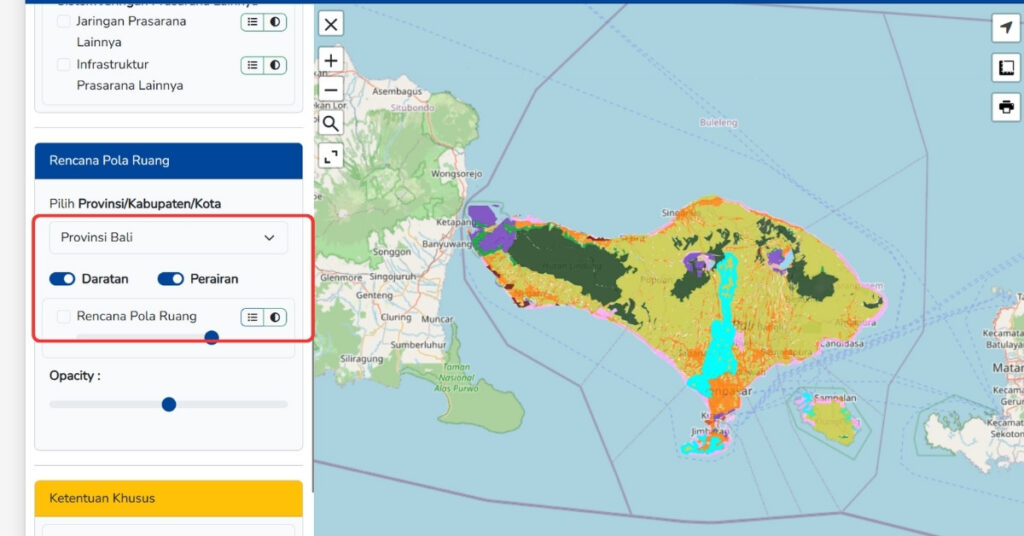
Next, switch on the zoning display by using the Daratan 그리고 Perairan options. For most property checks, you’ll want Daratan turned on because it shows the land area. You can also leave Perairan on if you want to see nearby water areas, but for normal land checks, Daratan is the main one you need.
Zoom In to Your Plot or Area
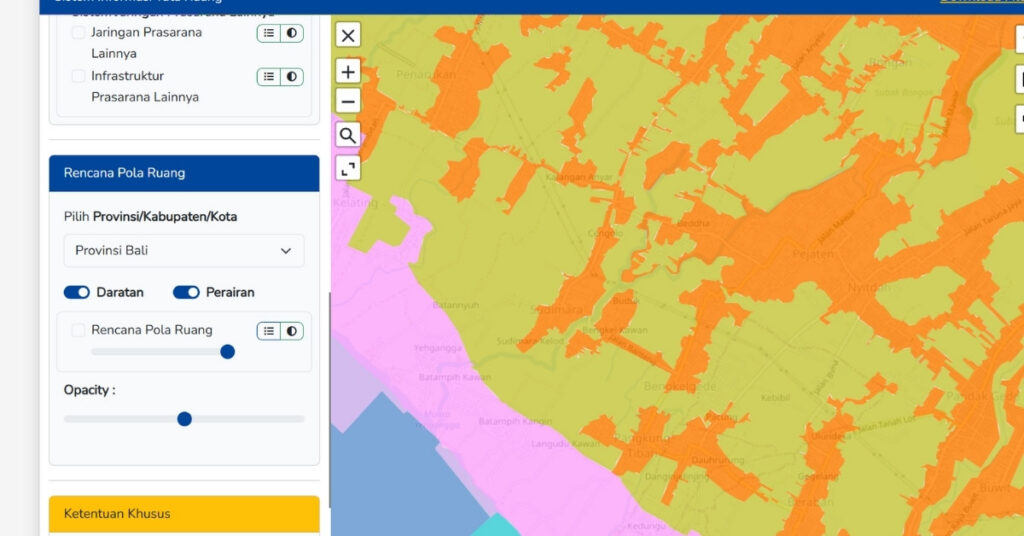
After the zoning layer is on, zoom in to the location you want to inspect. You can use the map controls on the screen to get closer and closer until you can clearly see the plot, road, or neighborhood you want to review. The more you zoom in, the easier it is to read the zoning colors accurately.
Wait for the Colors to Fully Load
On the last step, give the map a little time. After you turn on the zoning layer, the color markings may not appear instantly, especially if the website is loading a large area. So before you decide what zone the land is in, wait until the colors fully load. This helps you avoid reading the map too early and getting the wrong result.
The GISTARU Bali map is very useful for an early zoning check, but you should treat it as your starting point. For any formal decision, it is still smart to confirm the zoning with the right professional or local authority.
What the zoning map can and cannot tell you
A zoning map is useful, but you should not treat it like a final legal answer. It helps you see the planning picture of a plot, but it does not answer every legal question by itself.
First, the map helps you identify the zone, which is a good starting point. But in Bali, the public map is not always the only thing that matters. The official guidance itself says the map is public information, refers back to the legal planning documents, and cannot be the only basis for issuing KKPR if there is a more detailed operational plan for that area. So, you should treat the map as an early screening tool, not as a replacement for full due diligence.
Second, the map does not answer questions about ownership. This is where many people get confused. Zoning is separate from foreign ownership rules, company structures, and land title issues. A plot can be in the right zone for your project and still have ownership problems. On the other hand, a plot can have a land certificate and still be the wrong zone for what you want to do.
Third, zoning does not automatically mean you can get building permits. For business or development projects, zoning is usually just one part of a bigger compliance process. If you move forward with the project, you may still need a spatial conformity review, a technical building review, and later-use approvals. That is why you should treat zoning as your first filter, not your final step.
Bali zoning is local, not one-size-fits-all
One more point matters. Bali is part of Indonesia, but zoning is still applied through planning documents and local layers that affect specific places. So while Indonesia has national planning laws and systems, the real answer for a specific plot comes from the applicable mapping and planning framework for that location.
That is why buyers often work with parties who understand both national systems and on-the-ground practices in Bali, including local regulations, local authorities, and relevant local government offices. The more site-specific the project, the more important that local reading becomes.
최종 요점
If you remember only one thing, remember this: do not buy land in Bali before you understand its zoning.
Bali land zoning is not just a technical detail. It shapes whether your plot is suited to a home, farming, tourism, or business. It affects risk, cost, timing, and the chances that your project can move forward the right way.
So before you commit to a plot for private villas, rental villas, a home, a shop, or a larger investment, do four things. Get the exact plot data. Check the official zoning maps. Match the zone to your real intended use. Then confirm the answer before signing anything.
That is the smarter way to approach land zoning in Bali. It is also the safer way to protect your money, your timeline, and your plans.